
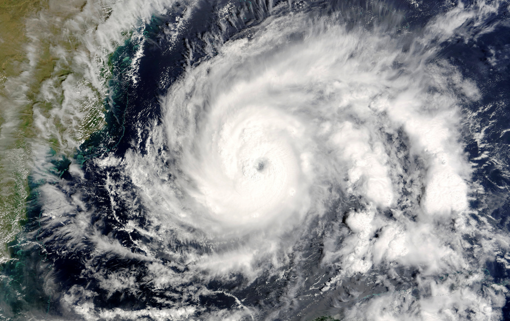

A new hurricane season is underway. It officially begins on May 15 in the Eastern Pacific. Then, on June 1, the season also starts in the Atlantic basin (including the Atlantic Ocean, Caribbean Sea, and Gulf of Mexico) as well as in the Central Pacific region (including the Hawaiian Islands). In all three regions, the official season runs through November 30.
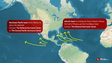
Basins of tropical cyclone activity in the Atlantic and Northeastern Pacific, NOAA
The official hurricane season marks the time of year when tropical cyclones are most likely to develop over the warm waters of the Atlantic and Eastern Pacific. According to the National Hurricane Center (NHC), more than 97% of tropical cyclone activity in the Atlantic occurs during this designated period.
However, tropical cyclones can also form outside of this timeframe. The earliest Atlantic hurricane ever recorded formed on March 7, 1908.
For the National Hurricane Center (NHC) in Miami and the Central Pacific Hurricane Center (CPHC) in Honolulu, the start of the official season also signals the beginning of regularly scheduled Special Tropical Weather Outlooks, issued four times a day.
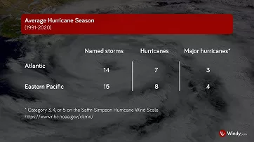
Average annual number of named storms and hurricanes, NOAA
An Average Hurricane Season
According to NHC statistics, the highest number of named storms (meaning tropical cyclones that reach tropical storm or hurricane strength) forms in the Eastern Pacific, with an average of 15 per year. The Atlantic produces around 14 named storms annually. However, tropical cyclone activity in the Atlantic basin poses a greater threat to the U.S. and nearby coastal regions, as those storms are more likely to make landfall.
Tropical cyclones typically track west to northwest in tropical and subtropical latitudes (between 5° and 30° N). In the Atlantic, this movement often steers storms toward the eastern shores of North America. Meanwhile, in the Northeastern Pacific, storms usually track out to sea, staying well away from the western coast.
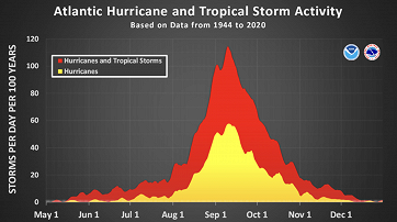
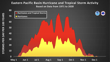
Daily tropical cyclone activity in the Atlantic and Eastern Pacific (May–Dec), NOAA
Tropical cyclone activity usually reaches its highest levels between August and September. In the Atlantic basin, the season typically peaks around September 10. In the Eastern Pacific, the most active period often occurs a bit earlier, generally toward the end of August.
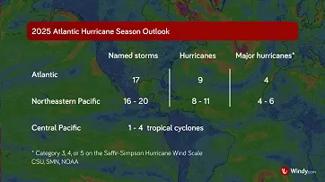
Forecast number of named storms and hurricanes for the 2025 hurricane season, CSU/SMN/NOAA
2025 Hurricane Season Forecast
Current projections indicate that the 2025 hurricane season will be more active than usual in the Atlantic and Northeastern Pacific, while the Central Pacific is expected to see near- or below-normal activity.
In the Atlantic, Colorado State University (CSU) forecasts 17 named storms, including 9 hurricanes and 4 major hurricanes (category 3 or higher). Although activity is expected to be above average, it may still fall slightly below the extremely active 2024 season. CSU will update its forecast on June 11, July 9, and August 6.
In the Northeastern Pacific, Mexico’s meteorological service (SMN) predicts 16 to 20 named storms, 8 to 11 hurricanes, and 4 to 6 major hurricanes.
In the Central Pacific, the National Oceanic and Atmospheric Administration (NOAA) expects 1 to 4 tropical cyclones. Unlike forecasts for other regions, this outlook includes all storm types, from tropical depressions to hurricanes.
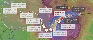
Windy.com Hurricane Tracker, Windy.com
Stay Safe
Be prepared, no matter the forecast. Have a plan for you and your family in case a hurricane threatens. Find safety tips at ready.gov/hurricanes.
Stay one step ahead with Windy.com. The Hurricane Tracker lets you follow storms from their formation all the way through to forecast updates. You can also explore radar and satellite imagery, plus detailed weather layers to help you stay informed in real-time.
Media contact: press@windy.com
Comments (6)