
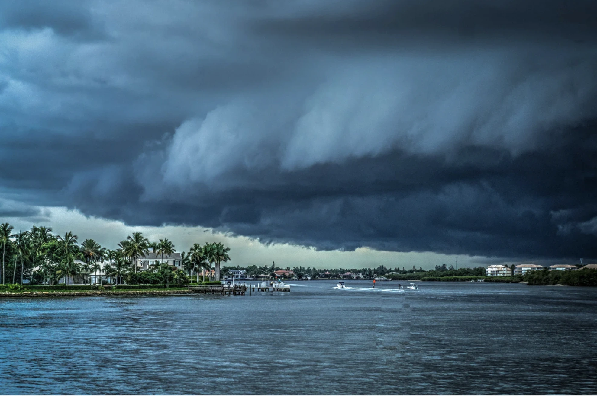

All of these terms refer to different forms of tropical cyclones—rotating, organized systems of clouds and thunderstorms that occur in tropical and subtropical regions.
A tropical cyclone is a low-pressure system that forms over warm ocean waters, most commonly between 5° and 25° latitude. In the Northern Hemisphere, it rotates counterclockwise; in the Southern Hemisphere, it spins clockwise.
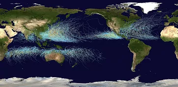
Global tropical cyclone tracks from 1985 to 2005; Wikimedia Commons
What Makes a Tropical Cyclone Unique?
Unlike mid-latitude low-pressure systems (also known as extratropical cyclones), which typically occur between 35° and 65° latitude, a tropical cyclone is symmetrical, has a warm core, lacks frontal boundaries, is generally smaller in size, and may exhibit significantly lower central pressure. Because of the steep pressure gradient over a relatively short distance, tropical cyclones can produce extremely strong and destructive winds.
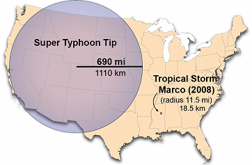
The largest and smallest recorded tropical cyclones, shown relative to the size of the United States; NOAA
To put it into perspective: the lowest central pressure ever recorded in a tropical cyclone was 870 hPa, and the largest observed diameter reached 2220 km (1380 miles). Both of these records were set by Supertyphoon Tip, which swept through the northwestern Pacific in October 1979.
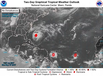
Tropical Weather Outlook showing a hurricane, two tropical storms, and no depressions or disturbances; NOAA
From Disturbance to Monster
The development of a tropical cyclone begins with a tropical disturbance. At this early stage, cumulus clouds begin to form, but the wind field does not yet contain a closed cyclonic circulation.
If conditions are favorable and the circulation becomes closed around the system’s center, a tropical cyclone forms. Its classification then depends on the strength of its sustained winds:
If winds are below 39 mph (62 km/h), it is called a tropical depression.
At 39–73 mph (63–118 km/h), it is classified as a tropical storm and given a name.
Once winds exceed 74 mph (119 km/h), the system is known as a hurricane, typhoon, or severe tropical cyclone, depending on the region.
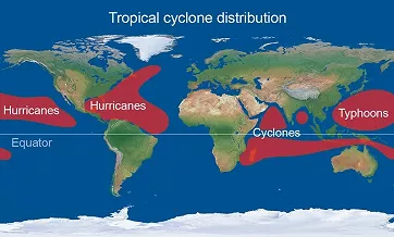
Tropical cyclone naming by geographic region; MetOffice
From Category 1 to 5: How Hurricanes Are Rated
Hurricanes are further classified by wind speed using the five-level Saffir-Simpson Hurricane Wind Scale. This scale considers only the storm’s sustained wind speed and does not account for other hazardous impacts such as storm surge, flooding from heavy rainfall, or tornadoes. At Category 5, the hurricane’s sustained winds exceed 157 mph (252 km/h), and the result is often catastrophic destruction.
A storm is referred to as a major hurricane if it reaches Category 3 or higher.
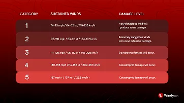
Saffir-Simpson Hurricane Wind Scale; NOAA
Types of Damage Caused by Hurricane Winds; NOAA/UCAR
In the case of typhoons, the category of a super typhoon is defined when sustained winds exceed 150 mph (241 km/h).
An Unimaginable Amount of Energy
In just one day, an average tropical cyclone can release approximately 5.2 × 10¹⁹ joule (J) of energy through the condensation of water vapor, which is equivalent to about 14400 terawatt-hours (TWh). According to EMBER, the world’s total electricity production in 2024 was 30850 TWh. That means a single tropical storm can, in one day, generate nearly half of the world’s annual electricity output, and we're talking about an average cyclone, not an extreme case like Supertyphoon Tip.
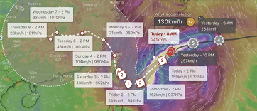
Hurricane Tracker on Windy.com
Stay Informed with Windy
Windy and its Hurricane Tracker tool let you follow tropical cyclones from their formation through to the latest forecast updates. It displays the storm’s past track, projected path, and expected changes in intensity. Combined with satellite and radar imagery, as well as layers showing wind speed and precipitation, you’ll always have a clear overview of the risks a tropical cyclone may pose in your area.
コメント (0)