
Bridgetown
Roseau
St. John's
Road Town
Lesser Antilles
Mérida
Managua
Honduras
Belmopan
Bilwi
Nicaragua
George Town
Cancún
Cuba
Holguín
Kingston
Port-au-Prince
Caribbean Sea
Dominican Republic
Guadalajara
Acapulco
Mexico City
Tuxtla Gutiérrez
Guatemala
Guatemala City
Bahamas
Nassau
Miami
Florida
Tallahassee
Gulf of Mexico
Havana
Monterrey
Ciudad Victoria
Baton Rouge
Louisiana
Austin
Texas
Hamilton
Virginia
Ohio
Kentucky
Tennessee
Indiana
Alabama
Georgia
Montgomery
Mississippi
Illinois
Nashville
Indianapolis
Springfield
Frankfort
Charleston
Columbia
Columbus
Atlanta
Jackson
Arkansas
Oklahoma
Missouri
Kansas
Dallas
Jefferson City
Little Rock
Oklahoma City
Topeka
United States
Lincoln
Lamar
Amarillo
New Mexico
Santa Fe
Lubbock
Gallup
Utah
Phoenix
Arizona
Colorado
Denver
Salt Lake City
New Brunswick
Halifax
Nova Scotia
Fredericton
Charlottetown
Gulf of Saint Lawrence
Newfoundland
Maine
Quebec
Saguenay
Montpelier
Albany
Ottawa
Lake Ontario
Augusta
Boston
New York
Pennsylvania
Sudbury
Toronto
Lake Erie
Michigan
Lansing
Wisconsin
Rouyn-Noranda
Lake Michigan
Lake Huron
Wawa
Marquette
Lake Superior
Thunder Bay
Madison
Iowa
Fargo
Hibbing
Bismarck
North Dakota
Minnesota
Saint Paul
Des Moines
Nebraska
Pierre
South Dakota
Cheyenne
Wyoming
Havre
Williston
Billings
Montana
Afton
Rapid City
Helena
Mexico
Culiacán
Chihuahua City
Ciudad Juárez
La Paz
Hermosillo
Richmond
Washington
Harrisburg
New York
North Carolina
Raleigh
© OpenStreetMap contributors
Wednesday 8
  • 03
  • 06
  • 09
  • 12
  • 03
  • 06
  • 09
Thursday 9
  • 03
  • 06
  • 09
  • 12
  • 03
  • 06
  • 09
Friday 10
  • 03
  • 06
  • 09
  • 12
  • 03
  • 06
  • 09
Saturday 11
  • 03
  • 06
  • 09
  • 12
  • 03
  • 06
  • 09
Sunday 12
  • 03
  • 06
  • 09
  • 12
  • 03
  • 06
  • 09
Monday 13
  • 03
  • 06
  • 09
  • 12
  • 03
  • 06
  • 09
Tuesday 14
  • 03
  • 06
  • 09
  • 12
  • 03
  • 06
  • 09
Wednesday 15
  • 03
  • 06
  • 09
  • 12
  • 03
  • 06
  • 09
Thursday 16
  • 03
  • 06
  • 09
  • 12
  • 03
  • 06
  • 09
Friday 17
  • 03
  • 06
  • 09
  • 12
  • 03
  • 06
  • 09
Saturday 18
  • 03
  • 06
  • 09
  • 12
  • 03
  • 06
  • 09
Sunday 19
  • 03
  • 06
  • 09
  • 12
  • 03
  • 06
  • 09
Monday 20
  • 03
  • 06
  • 09
  • 12
  • 03
  • 06
  • 09
Tuesday 21
  • 03
  • 06
  • 09
  • 12
  • 03
  • 06
  • 09
Wednesday 22
  • 03
  • 06
  • 09
  • 12
  • 03
  • 06
  • 09
12 AM
Go Premium
kt051020304060
Developed with
Download App
Lightning: How Electrical Discharges Form in Thunderstorms
Jari Sochorová
-
updated 4h ago
212
...

Lightning is a fascinating natural phenomenon and one of the fastest and most dangerous weather-related events for human society.

In physical terms, lightning is essentially a gigantic spark of static electricity, but one that can:

  • reach extraordinary lengths: the world record for the longest single lightning flash is 829 km ± 8 km (515 ± 5 mi). It occurred on 22 October 2017 within a large thunderstorm system stretching from northeastern Texas into central Kansas and Missouri. The record was confirmed in 2025 through the analysis of GOES-16 satellite data.
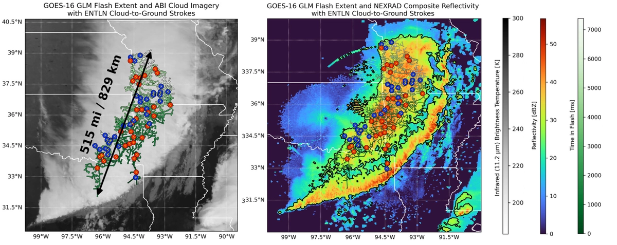
The flash structure recorded by the GOES-16 GLM instrument is shown together with 116 CG strokes marked by lightning symbols and colour-coded by polarity: blue = negative, red = positive (left). Radar reflectivity is shown in colour (right); WMO

  • last for several seconds: the longest-duration lightning flash lasted 17.102 s. It was recorded on 18 June 2020 over Uruguay and northern Argentina.
  • be almost constantly present somewhere on Earth: on average, 44 ± 5 lightning flashes occur every second in Earth’s atmosphere. During summer in the Northern Hemisphere, this global average rises to 55 flashes per second, while during Northern Hemisphere winter it drops to 35 flashes per second.
  • be especially frequent in the tropics: lightning strikes that reach the ground are more common there than in most other parts of the world. One of the most active areas is around Lake Maracaibo in Venezuela, in northern South America, where some sources report up to 1.2 million lightning flashes per year. The average lightning flash density there is around 233 flashes per km² per year.
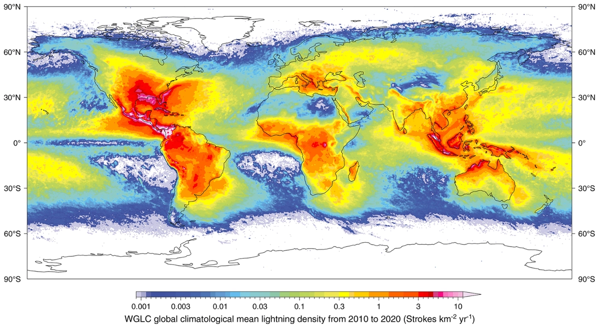
Climatological mean annual lightning stroke density (2010–2020); Kaplan et al. (2021)

  • pose a serious risk to people: lightning is estimated to cause around 24,000 deaths and 240,000 injuries every year. 

  • ignite wildfires: each year, lightning starts thousands of fires in vegetation, although their exact global number is difficult to determine. Lightning plays a particularly important role in remote boreal and temperate forests, such as those in Canada, Alaska, and Siberia. 

  • affect forests even without fire: according to new modelling calculations by the Technical University of Munich, around 320 million trees may die each year as a result of lightning strikes. This corresponds to 2.1 to 2.9% of the annual loss of plant biomass. Trees destroyed by fires ignited by lightning are not included in this estimate.
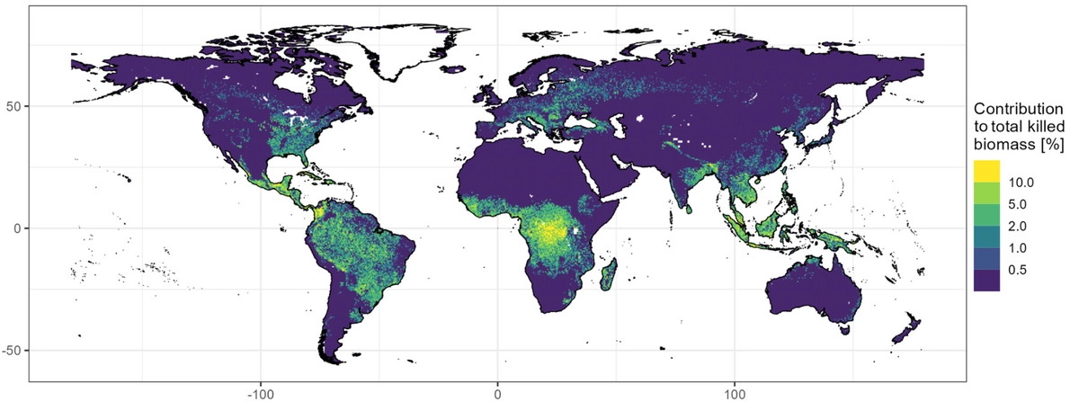
Lightning contribution to total biomass mortality; Krause et al. (2025)

In this article, we will focus on lightning that forms in thunderclouds. We will therefore take a brief look at atmospheric electricity, especially the branch concerned with electrical processes inside clouds.

What is lightning?

Lightning is a powerful electrical discharge in the atmosphere. It is a short-lived flow of electric current between regions of different electrical charge.

Under normal conditions, air in the troposphere, the lower part of the atmosphere extending roughly up to 12 km above the Earth’s surface, conducts electricity only very poorly. It is not a perfect insulator, however. A small number of positive and negative atmospheric ions, produced for example by natural radioactivity and cosmic rays, give it weak electrical conductivity.
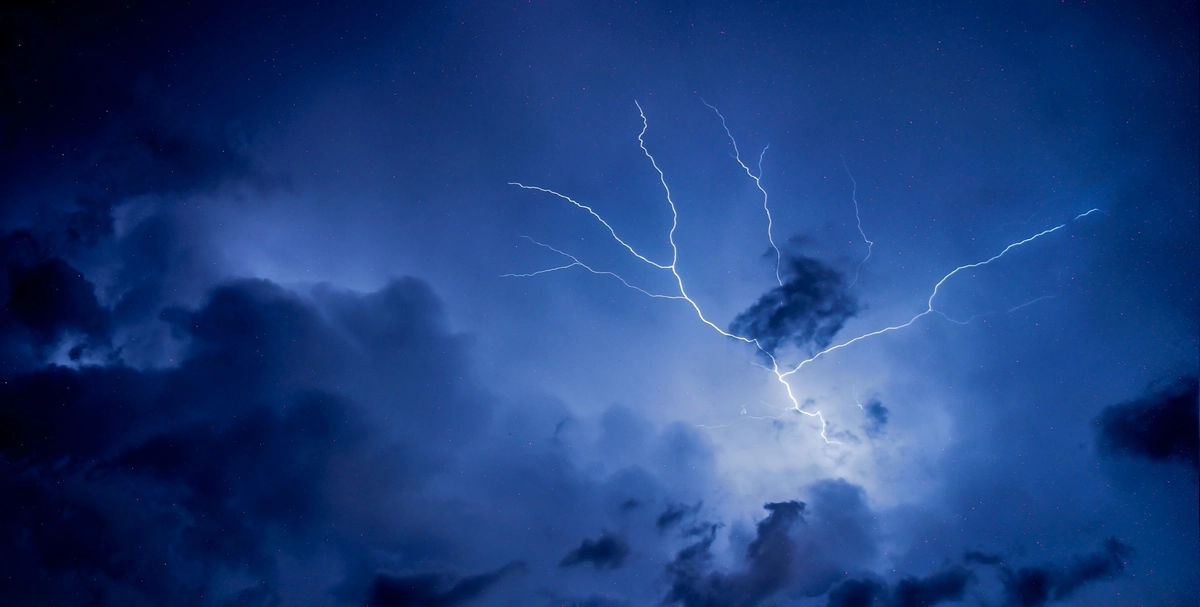
When regions of sufficient electrical charge form in the atmosphere, a strong electric field develops between them. This field can ionise air molecules, turning neutral particles into ions and free electrons. As a result, the air becomes more conductive, allowing a lightning discharge to pass through it.
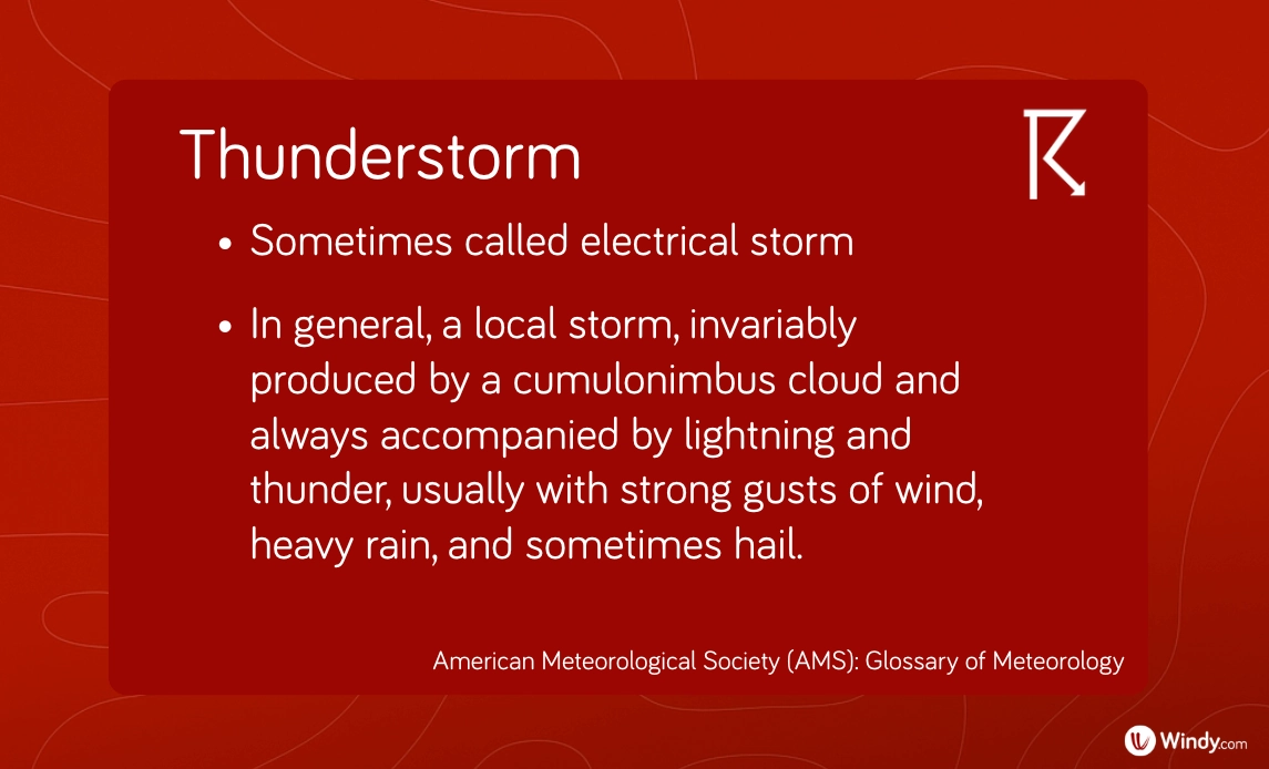
Lightning most often occurs in thunderstorms, in powerful convective clouds known as cumulonimbus clouds. These clouds provide the most favourable conditions for the accumulation and separation of electrical charge.

However, lightning is not limited to thunderstorms. It can also appear during volcanic eruptions, extremely intense wildfires, or surface nuclear detonations.

Definition of a thunderstorm by the American Meteorological Society; AMS

Types of lightning

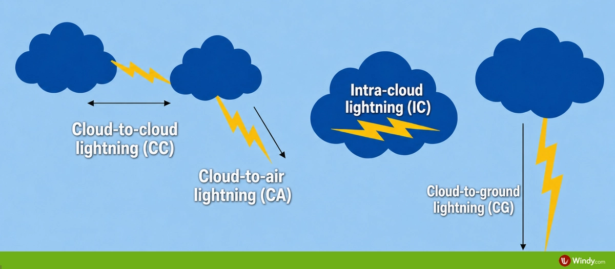
Most lightning flashes in a thunderstorm begin inside a cloud. Based on the path taken by the electrical discharge, several basic types of lightning can be distinguished.

Intra-cloud lightning (IC) refers to lightning within a single cloud. 

Cloud-to-cloud lightning (CC) is a discharge between two clouds. 

Cloud-to-air lightning (CA) refers to a discharge between a cloud and the surrounding air. 

Cloud-to-ground lightning (CG) is lightning between a cloud and the Earth’s surface.

The most common types are discharges that do not reach the ground, including IC, CC, and CA lightning. Together, they account for approximately 75 to 80% of all lightning flashes

Types of lightning

CG lightning is further classified by polarity. Depending on the type of charge transferred to the Earth’s surface, we refer to negative or positive CG lightning. Negative CG lightning transfers negative charge to the ground, while positive CG lightning transfers positive charge. 

Most CG flashes are negative, while positive CG flashes account for approximately 10% of cases.

You may also come across the term heat lightning. It is not a special type of lightning, but distant lightning whose thunder can no longer be heard. It can refer to any lightning type, including CG, IC, CA, or CC. Its reddish, “warm” colour may result from atmospheric scattering, similar to sunset colours.
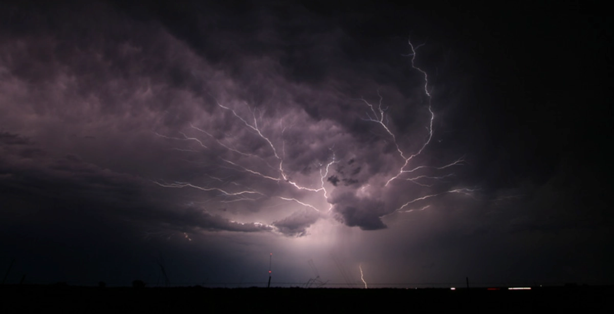
Spider lightning; NSSL NOAA 
Another common term is spider lightning, used for long, horizontally spreading and often branching lightning discharges that may resemble a spider’s web. 

Charge distribution in a thundercloud

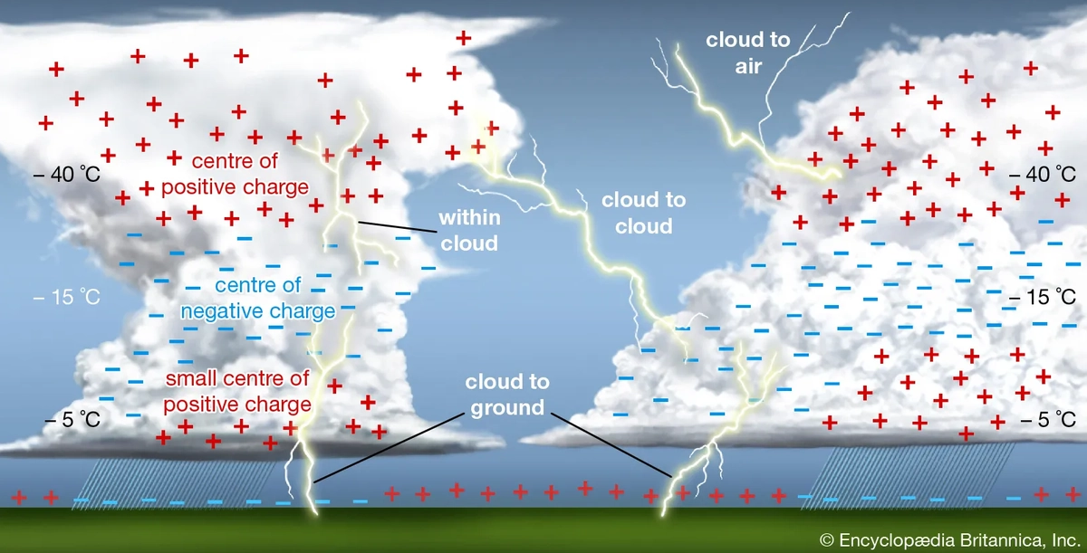
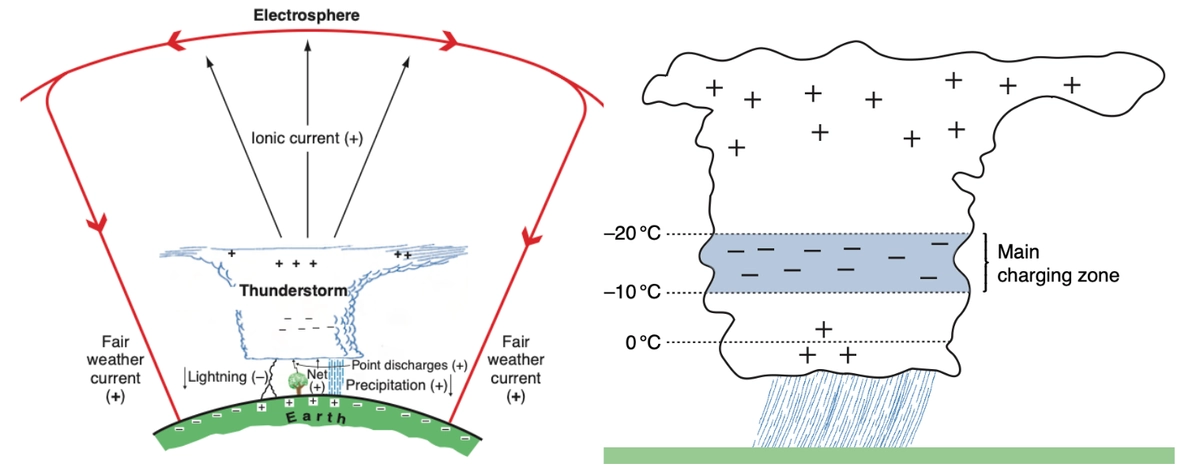
The distribution of electrical charge in a thundercloud can vary from case to case. However, observations suggest that it usually includes two to three main regions, known as charge centres.

Schematic of the global electrical circuit, with electrified clouds acting as generators (left). Electric charge distribution in a simple thunderstorm; the lower positive charge is not always present (right); Atmospheric Science: An Introductory Survey

The positive charge centre is usually located in the upper part of the cloud. The negative charge centre usually lies in the middle to lower part of the cloud, often near the −10 °C to −20 °C layer. These two main centres have roughly comparable charges of opposite sign, typically on the order of tens of coulombs

A secondary positive charge centre of a few coulombs may also appear in the lower part of the cloud.

The exact mechanism by which these charge centres form is not yet fully understood. Current evidence from observations and laboratory measurements suggests that charge is exchanged during collisions between small ice crystals and larger riming particles, such as graupel or hail, in the updraught region of a thundercloud. During these collisions, the small ice crystals become positively charged, while the riming particles become negatively charged.

Updraughts and gravity then help separate these particles. Small ice crystals are carried to higher levels, where they form the main positive charge centre. In mature storms, this positively charged region can extend into the anvil, which may spread far from the main storm core. Larger riming particles tend to remain in the middle or lower parts of the cloud, contributing to the formation of the negative charge centre.

Electrical charge distribution and lightning types in a thunderstorm; Britannica

In fair-weather conditions, the Earth’s surface typically carries a slight negative charge. When a thundercloud is present, its negatively charged lower region induces positive charge at the surface and on objects directly beneath it. If a positively charged anvil extends farther from the storm core, it can induce a negative charge on the ground beneath it. As this charge separation strengthens, the electric field between the cloud and the ground increases and can lead to the formation of CG lightning.

CG lightning is less common than discharges within clouds or between clouds. Satellite measurements suggest that cloud-to-ground lightning accounts for only about 25% of all lightning activity. One reason is that the electric field inside a thundercloud is often stronger than the field between the cloud and the ground.

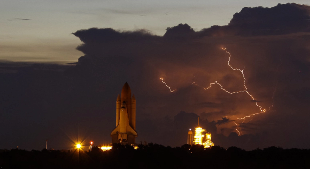
In 1969, lightning nearly jeopardised Apollo 12. The Saturn V rocket was struck twice shortly after launch, causing electronics and telemetry failures. The crew and mission control restored the systems, and the mission continued to the Moon; illustrative photo by Justin Dernier/EPA; NASA; NSSL NOAA

Phases of lightning

To the human eye, lightning often appears as a short, continuous flash. However, measurements of electric and magnetic fields, as well as high-speed camera footage, show that it actually consists of several distinct phases.
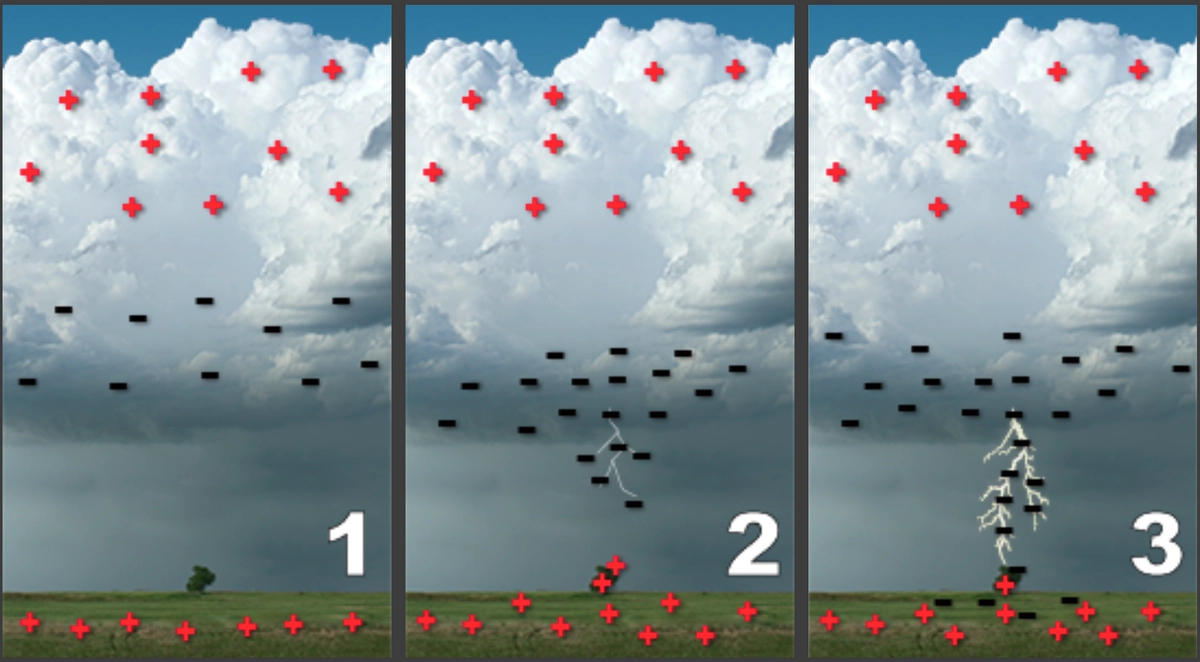
Lightning development between the cloud and the ground; NOAA

A negatively charged cloud-to-ground lightning discharge, or negative CG lightning, typically develops in the following stages:

First, electrical breakdown begins. In a strong electric field, part of the air ionises and becomes more electrically conductive. The first conductive channels then begin to form. This phase lasts only a few milliseconds.

This is followed by the formation of a negative stepped leader, a faint conductive channel that travels from the cloud towards the ground. It advances in individual steps at a speed of around 200 km/s. After roughly 50 metres, it pauses for about 20 to 50 microseconds before continuing. This uneven motion is probably caused by changes in the local electric field. The entire phase lasts approximately 10 milliseconds.
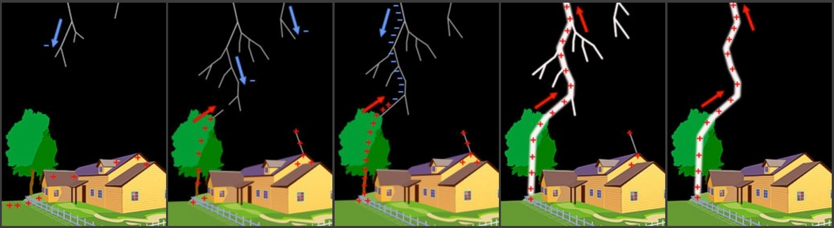
Formation of a negative cloud-to-ground lightning flash; NOAA

When the stepped leader approaches the Earth’s surface, positively charged upward streamers begin to rise towards it, most often from elevated objects such as a transmitter tower, a building, or a tree. Once one of these streamers connects with the leader, a continuous conductive channel is formed between the cloud and the ground, and the return stroke begins.

The return stroke travels upward along the channel that has already formed, from the ground towards the cloud. It carries positive charge upward and neutralises the negative charge that has accumulated in the channel. The return stroke is the brightest and most visible part of a cloud-to-ground lightning discharge. It is responsible for more than 99% of the light emitted during a lightning strike.
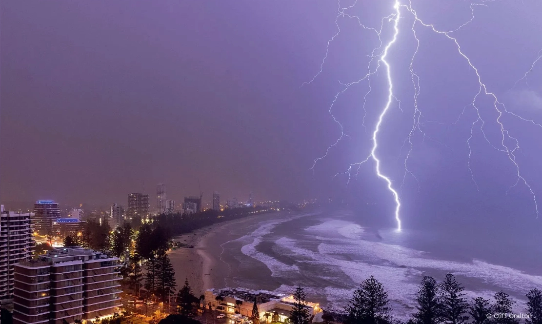
In photographs, lightning may appear to descend from the cloud. In reality, the very bright return stroke travels upward through the conductive channel, illuminating even the side branches of the stepped leader; photo by Cliff Gralton; BoM; NOAA

The return stroke can travel at speeds of up to 20,000 km/s. The current flowing through it can reach tens of kiloamperes, typically around 30 kA. Within a very short time, the air in the lightning channel is heated to more than 30,000 K. This heating is so rapid that the air does not have time to expand immediately, causing the pressure in the channel to rise sharply, to roughly 10 to 100 atmospheres. This highly compressed and intensely heated air then rapidly expands into the surrounding air. The result is a powerful pressure wave, which we hear as thunder.

A lightning discharge may end with the return stroke, but it is often followed by additional leader and return stroke sequences. On average, one visible lightning flash consists of 3 to 5 return strokes, although flashes with more than 20 return strokes have been documented. These repeated return strokes are why lightning often appears to flicker. The time between individual return strokes is on the order of milliseconds.

A high-speed camera captured stepped leaders and return strokes. At 4000 fps, 1 second of footage lasts 2 minutes and 13 seconds when played back at 30 fps; NOAA

Positive lightning

Most cloud-to-ground lightning discharges transfer negative charge to the ground, while only about 10% of lightning discharges in mid-latitude thunderstorms transfer positive charge to the ground.
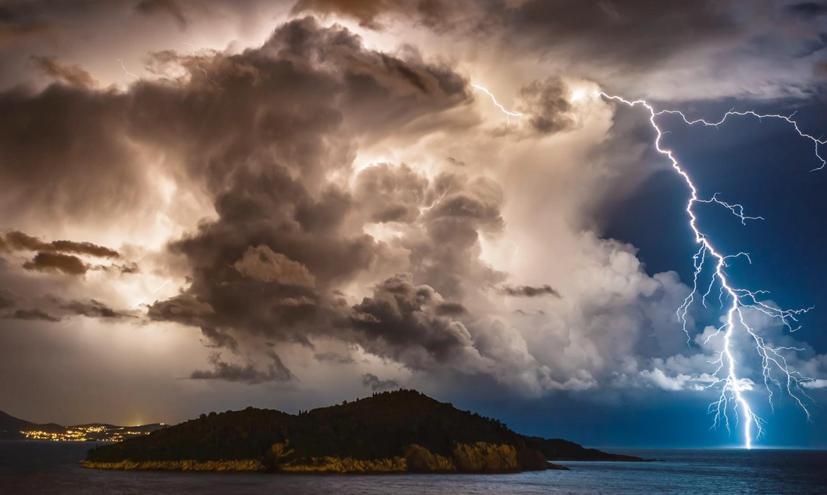
Positive lightning is less common because the centre of positive charge is located higher in the cloud, so a much larger difference in electric potential is needed for a discharge to occur. However, positive lightning can transfer a large amount of electric charge and reach high peak currents, making it potentially even more hazardous than negative lightning.

WMO 2016 Calendar Competition winner; photo by Daniel Pavlinovic; WMO

Positive leaders usually originate in the upper part of a thunderstorm cloud, where the main positive charge region is found. Under normal conditions, the Earth’s surface is partly shielded from this charge by the negatively charged region in the middle to lower part of the storm. However, if the cloud is tilted by wind shear, or if its anvil spreads far from the main updraft region, the upper positive charge can influence the surface more strongly. If the electric potential difference between this region and the ground becomes large enough, a positively charged leader can form and move downward towards the ground.

Positive lightning develops in a similar way to negative lightning. However, the descending stepped leader carries a positive charge, while the subsequent upward discharges from the ground carry a negative charge. Positive CG lightning usually has only one return stroke and is more often associated with a longer-lasting current flow than negative CG lightning.

The upper parts of a thunderstorm cloud can extend far beyond the storm’s precipitation core. Positive lightning can therefore strike unexpectedly more than 40 km (25 mi) from where rain is falling. 

Positive lightning is thought to play an important role in triggering some transient luminous events.

GOES-19 captured severe storms over the central USA on 21 June 2026, producing lightning, tornadoes and damaging winds.; CIRA NOAA

Ground current

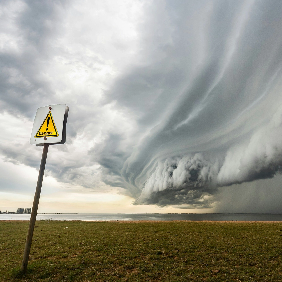
When lightning strikes the ground or an object on the ground, electric current spreads along the surface and through the shallow layer of the ground. This creates a dangerous ground current around the strike point, which can be fatal to both animals and people.

Turf damage caused by ground current from a lightning strike; photo by u/AlGamaty, Reddit; mrcc.purdue.edu

The ground near the strike point is at a much higher electric potential than areas farther away. If different parts of the body touch the ground at points with different potentials, an electric current can pass through the body. This risk increases with the distance between the contact points. For example, the farther apart the feet are, the greater the voltage difference between them can be. This is known as step voltage.

The risk of injury can be reduced by keeping the feet as close together as possible. Animals may be more vulnerable to ground current because their legs are usually farther apart than human feet.
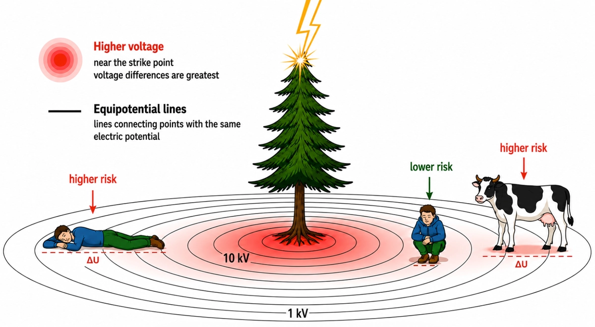
During a thunderstorm, keep your feet close together to reduce step voltage; based on Bergwetter (2013)

To reduce the risk of a direct lightning strike or injury from ground current, seek safe shelter, such as in a building or a car. If this is not possible, leave elevated areas, stay out of water, avoid lying on the ground, and keep a safe distance from tall objects, trees, and rock faces. You can find more information on how to stay safe during a thunderstorm on NOAA’s website.

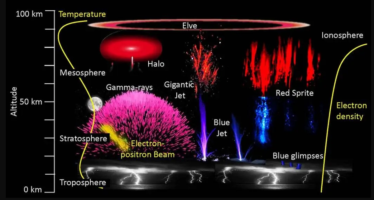
Transient luminous events, TLEs

Strong, large convective storms can also be associated with transient luminous events (TLEs). These are electrical discharges that occur above convective storms, most often at altitudes from about 15 km to around 90 km above the ground.

Because the air at these altitudes is very thin, TLEs do not take the form of ordinary lightning. Instead, they appear as short-lived flashes of light, lasting only a few hundredths to a few tenths of a second, and are usually very difficult to detect with the naked eye.

This illustration shows the variety of upper-atmospheric phenomena powered by thunderstorms; NASA

The colour of TLEs depends mainly on which molecules and atoms in the upper atmosphere receive energy from the electric field, and at what altitude this occurs. As these particles return to a lower energy state, they emit light at specific wavelengths, producing specific colours.

TLEs are still the subject of ongoing research, as some aspects of their formation, development and differences between the various types are not yet fully understood. Among the best-known TLEs are sprites, elves and blue jets.

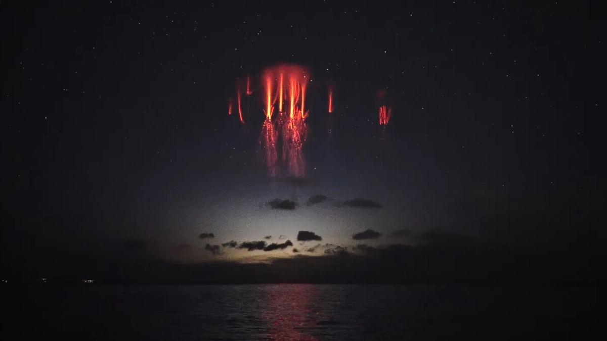
Sprites are brief, faint luminous discharges high above active thunderstorms, often occurring almost simultaneously with strong positive CG lightning; photo by Thanasis Papathanasiou; NASA

Lightning on Windy.com

On Windy.com, you can display current lightning activity from a ground-based sensor network, which primarily detects CG lightning but can also detect some IC discharges.

Lightning can be displayed together with radar or satellite data. The colour of the hatching shows when lightning occurred in a given area during the past 24 hours: black indicates lightning from the past hour, brown indicates lightning from 1 to 6 hours ago, and yellow indicates lightning from 6 to 24 hours ago.

The Thunderstorms forecast layer shows a model estimate of lightning activity density, expressed in flashes km⁻² day⁻¹. The value represents an averaged estimate of the total lightning flash density for the period leading up to the given forecast time.

The calculation is based on an empirical relationship using information about convective clouds and precipitation, CAPE, and the height of the convective cloud base.

Because it is a model estimate based on parameterized convection, it should not be interpreted as a forecast of specific lightning strikes or their exact number. However, it can be used as an indicator of convective activity. In general, higher forecast lightning density suggests conditions more favourable for stronger thunderstorm activity.

The exact time and location of a specific lightning strike cannot currently be predicted with certainty.

212 claps

Comments (16)

Karin Smith
Karin Smith 20h ago
Windy is the best weather APP in the world. Progressive, detailed, accurate. You are my favourite crew member.
Phibee
Phibee 1 days ago
thank you very well written
Shadetree Apiary 13h ago
Excellent article. Best weather information available.
Donald Bayat 14h ago
Good learning course, thanks.
Afzal Bhutto
Afzal Bhutto 18h ago
I like this app
Live Alerts Now Go Further: Hurricanes and CAP Alerts At Any Place You Choose
Nicole Dolezalova
-
updated 1 days ago
Multimodel Approach to Weather Forecasting: Predictability and Probability
Jari Sochorová
-
updated 14 days ago
Thermals: the invisible engine of unpowered flight
Jari Sochorová
-
updated 22 days ago
What's New on Garmin: The Windy Update You May Have Missed
Nicole Dolezalova
-
updated 29 days ago
Windyty, S.E. Acquires Majority Stake in meteoblue, A.G.
-
updated 42 days ago
What's New in v50: Read the Avalanche Bulletins, Trace the Wind, Plan the Passage
Nicole Dolezalova
-
updated 42 days ago
Holiday Update: New Tools for Winter Weather and Ocean Forecasts, Meet Version 48
-
updated 49 days ago
Winter Weather: From Snowflakes to Extreme Snowfall
-
updated 57 days ago
What's New in v49: Faster, Smarter and made to Fly
-
updated 62 days ago
Windy Gets Smarter with Speed Vector and iOS Webcam Widgets
Nicole Dolezalova
-
updated 81 days ago